-
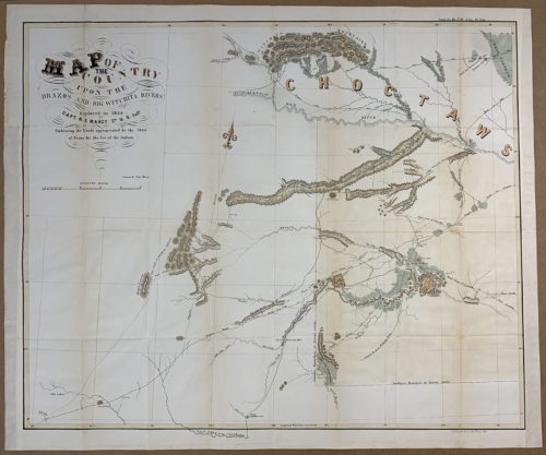 “Map of the Country Upon the Brazos and Big Witchita Rivers” Rare Original Map, circa 1854 impressive size approximately 33" wide x 28" tall"
 -
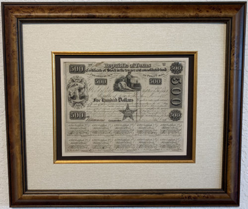
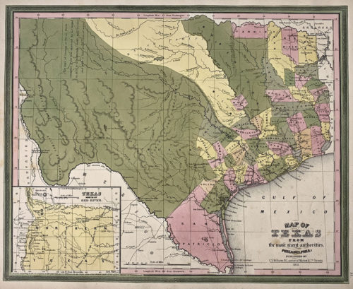 Original Map of the Republic of Texas, circa 1845 with early counties approximately 15" wide x 13" tall"
Please contact the gallery for details on this fine acquisition as well as information about our collection of original historic selections.
-
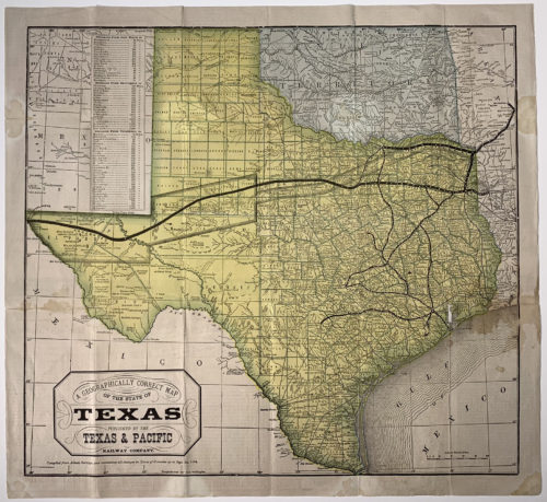 Original Map of the State of Texas, circa 1876 approximately 21" wide x 18" tall"
Please contact the gallery for details on this fine acquisition as well as information about our collection of original historic selections.
-
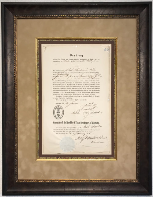
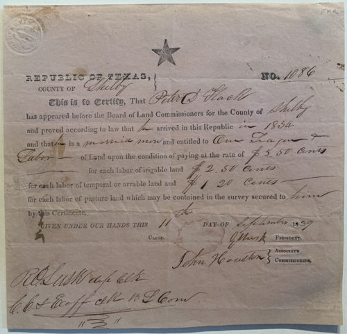 Sold Right to Buy Land and Settle in Texas Rare Original Document approximately 7" wide x 7" tall" Please contact the gallery for information on our collection of fine original maps and documents.
 -
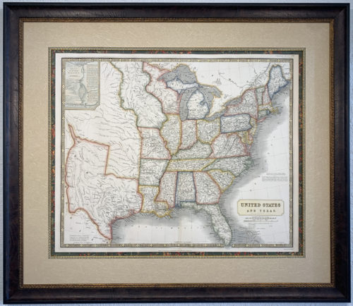
 Original Map of the Republic of Texas including the United States, Mexico and Surrounding Areas By Justus Perthes, circa 1848, Gotha approximately 17" wide x 14" tall"
Please contact the gallery for details on this fine acquisition as well as preferred pricing and details on our custom archival framing services for fine original maps and documents.
-
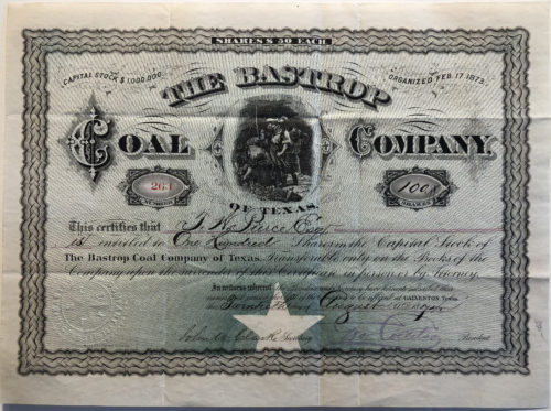 Engraved Original Stock Certificate for 100 Shares on the Capital Stock of the Bastrop Coal Company of Texas, circa 1874 approximately 11" wide x 9" tall"
Please contact the gallery for details on this fine acquisition as well as information about our collection of original historic selections.
-
Bearing the Official Paper Seal of the Republic of Texas
Please contact the gallery for details on this fine acquisition.
approximately 18" x 24" framed Framing may vary. Please contact the gallery for description. -
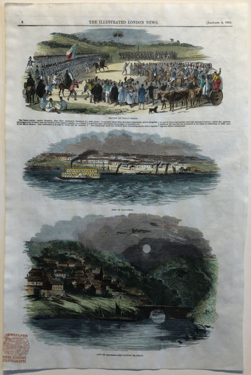 Hand Colored Engraving From the January 4, 1845 Edition of The Illustrated London News approximately 10" wide x 15" tall
Please contact the gallery for details on this fine acquisition as well as information about our collection of original historic selections.
-
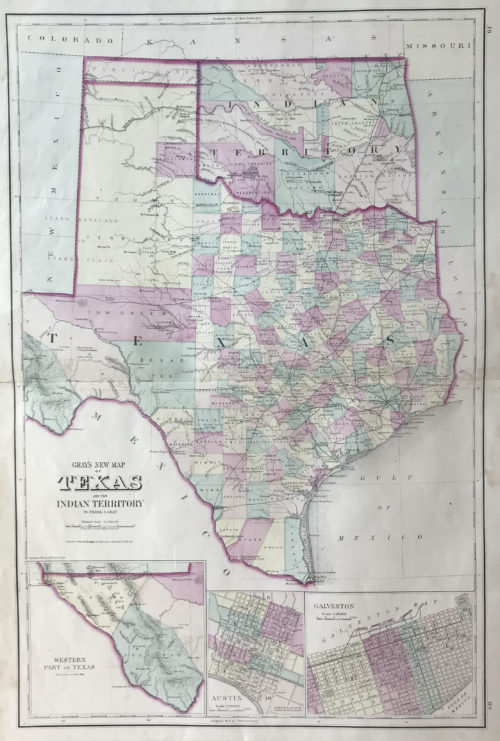 by O. W. Gray and Son, Philadelphia, circa 1875 approximately 15" wide x 28" tall"
Please contact the gallery for details on this fine acquisition as well as information about our collection of original historic selections.
-
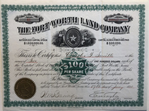 Engraved Original 19th Century $100 Stock Certificate This certifies that Charles F. Smith is the owner of Two Shares of one hundred dollars each of the Capital Stock of the Fort Worth Land Company of Fort Worth, Texas Signed July 1890 approximately 11" wide x 8" tall"
Please contact the gallery for details on this fine acquisition as well as information about our collection of original historic selections.
-
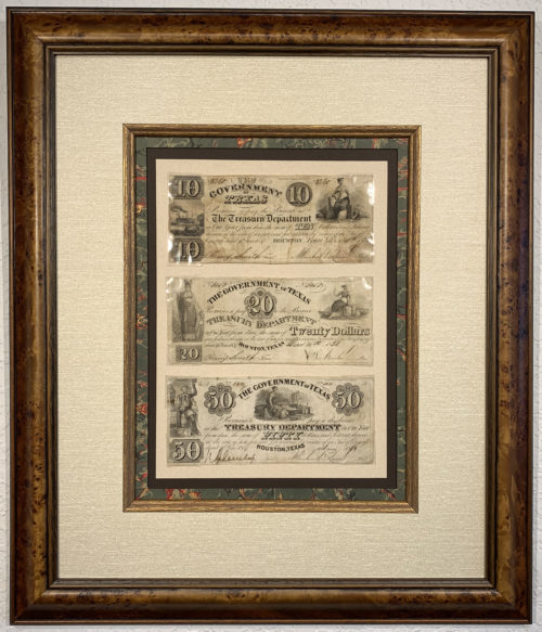
framed with museum archival materials, Italian burl molding and UV shielding glass
approximately 18" x 21"
Please contact the gallery for details on this fine Original Banknote Collection.
-
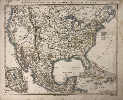
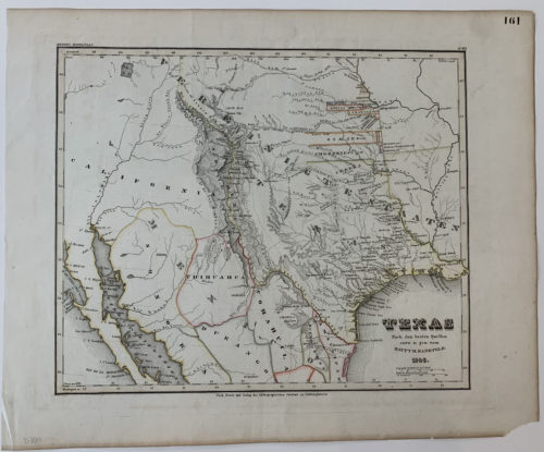 SOLD The German Version of Emory’s Rare Map of the Republic of Texas Original Hand Colored Map of Texas Circa 1846, Germany approximately 18" wide x 14" tall" Pease contact the gallery for details on our collection of other fine original maps and documents.
 -
framed with museum quality archival materials, Italian burl molding and UV shielding glass
approximately 17"wide x 14" tall
Please contact the gallery for details on this fine original selection.
-
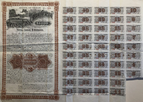 Ornately Engraved Original 19th Century Bond, circa 1896 with attached coupons and small inset map of Aransas Pass and surrounding areas showing shipping and railroad routes approximately 23" wide x 17" tall"
Please contact the gallery for details on this fine acquisition as well as information about our collection of original historic selections.
-
Rare Original Engraved and Hand-tinted Map
by A. K. Johnston, a member of the Royal Geographic Society and Engraver to Queen Victoria with offices at # 4 Saint Andrews Square – Edinburgh, Scotland Approximately 36" wide by 30" tall. Framing may vary. Please contact the gallery for details on this fine Original Map. -
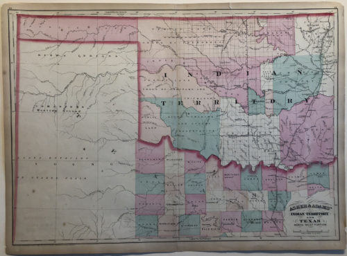
Original Map circa 1874
By Asher & Adams, New York One of the earliest large format separate maps of the Indian Territory and one of the first to appear in a commercial Atlas. approximately 24" wide x 17" tallPlease contact the gallery for details on this fine acquisition as well as information about our collection of original historic selections.
-
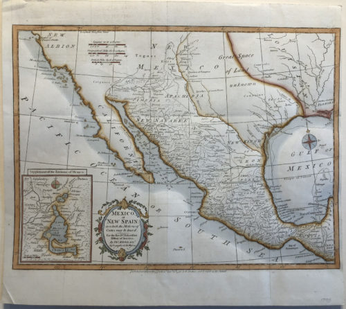
Original Map of Mexico or New Spain
In which the motions of Cortez may be traced Circa 1795, By T. Kitchin, London Hydrographer to his Majesty approximately 15" wide x 11" tallPlease contact the gallery for details on this fine acquisition as well as information about our collection of original historic selections.
-
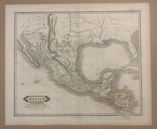
Original Map of the Republic of Texas and Mexico, circa 1842
Very Rare Map Naming the Republic of Texas Published by W.H. Lizars, Edinburgh approximately 20" wide x 17" tall Contact the gallery for information on this fine original map. -
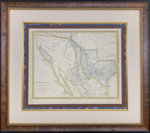
Rare Original Engraved and Hand-tinted Map
Republic of Texas & the Northern States of Mexico circa 1842, Chapman & Hall, London for the Society for the Diffusion of Useful Knowledge Approximately 27" wide by 24" tall. Framing may vary. Please contact the gallery for details on this fine Original Map. -
With Hand Colored Border Showing the Butterfield Stage Route Circa 1861, Johnson and Ward The Butterfield Overland Mail Route, St. Louis to San Francisco in 25 Days Flat September, 1858 through February, 1861 Approximately 26" wide x 17" tall
Please contact the gallery for details on this fine acquisition as well as information about our collection of original historic selections.
-
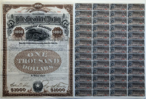 Ornately Engraved Original First Consolidated Mortgage Thirty Year 6% Gold Bond, circa 1890 with attached coupons approximately 21" wide x 14" tall"
Please contact the gallery for details on this fine acquisition as well as information about our collection of original historic selections.