-
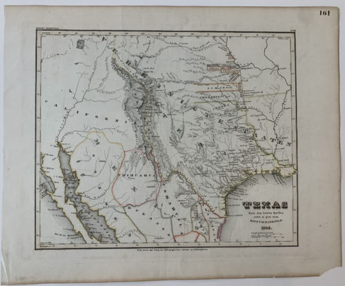 SOLD The German Version of Emory’s Rare Map of the Republic of Texas Original Hand Colored Map of Texas Circa 1846, Germany approximately 18" wide x 14" tall" Pease contact the gallery for details on our collection of other fine original maps and documents.
 -
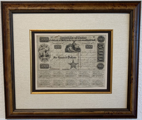
framed with museum quality archival materials, Italian burl molding and UV shielding glass
approximately 17"wide x 14" tall
Please contact the gallery for details on this fine original selection.
-
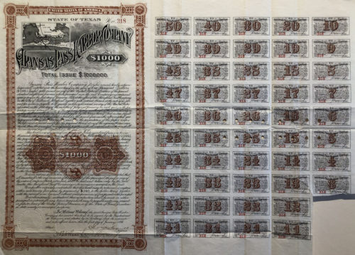 Ornately Engraved Original 19th Century Bond, circa 1896 with attached coupons and small inset map of Aransas Pass and surrounding areas showing shipping and railroad routes approximately 23" wide x 17" tall"
Please contact the gallery for details on this fine acquisition as well as information about our collection of original historic selections.
-
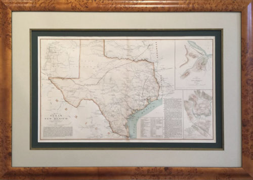
Rare Original Engraved and Hand-tinted Map
by A. K. Johnston, a member of the Royal Geographic Society and Engraver to Queen Victoria with offices at # 4 Saint Andrews Square – Edinburgh, Scotland Approximately 36" wide by 30" tall. Framing may vary. Please contact the gallery for details on this fine Original Map. -
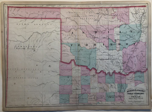
Original Map circa 1874
By Asher & Adams, New York One of the earliest large format separate maps of the Indian Territory and one of the first to appear in a commercial Atlas. approximately 24" wide x 17" tallPlease contact the gallery for details on this fine acquisition as well as information about our collection of original historic selections.
-
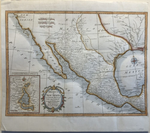
Original Map of Mexico or New Spain
In which the motions of Cortez may be traced Circa 1795, By T. Kitchin, London Hydrographer to his Majesty approximately 15" wide x 11" tallPlease contact the gallery for details on this fine acquisition as well as information about our collection of original historic selections.
-
Original Map of the Republic of Texas and Mexico, circa 1842
Very Rare Map Naming the Republic of Texas Published by W.H. Lizars, Edinburgh approximately 20" wide x 17" tall Contact the gallery for information on this fine original map. -
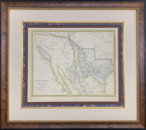
Rare Original Engraved and Hand-tinted Map
Republic of Texas & the Northern States of Mexico circa 1842, Chapman & Hall, London for the Society for the Diffusion of Useful Knowledge Approximately 27" wide by 24" tall. Framing may vary. Please contact the gallery for details on this fine Original Map. -
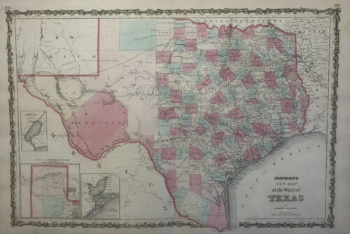
With Hand Colored Border Showing the Butterfield Stage Route Circa 1861, Johnson and Ward The Butterfield Overland Mail Route, St. Louis to San Francisco in 25 Days Flat September, 1858 through February, 1861 Approximately 26" wide x 17" tall
Please contact the gallery for details on this fine acquisition as well as information about our collection of original historic selections.
-
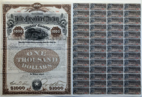 Ornately Engraved Original First Consolidated Mortgage Thirty Year 6% Gold Bond, circa 1890 with attached coupons approximately 21" wide x 14" tall"
Please contact the gallery for details on this fine acquisition as well as information about our collection of original historic selections.
-
Including the Forts & Army Posts in West Texas & New Mexico
Published by the Bureau of Topographic Engineers. Circa 1857, Washington Contact the gallery for details in this fine selection. -
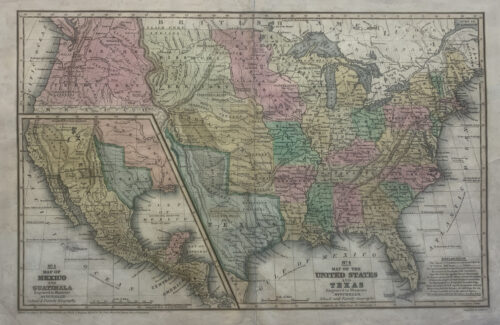
Original Map of the Republic of Texas and the United States, circa 1842
Very Rare Map Naming the Republic of Texas Published by W.H. Lizars, Edinburgh Framed in darkwood, approximately 32" x 28"Please contact the gallery for details on this fine acquisition as well as information about our collection of original historic selections.
-
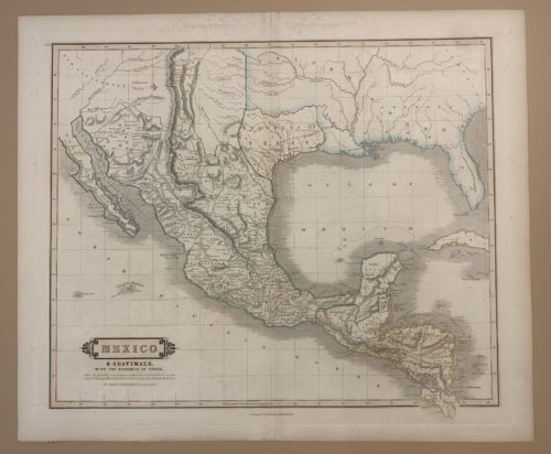
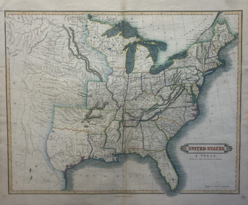
Original Map by Samuel Augustus Mitchell
circa 1839, Connecticut approximately 17" wide x 11" tall"Please contact the gallery for details on this fine acquisition as well as information about our collection of original historic selections.
-
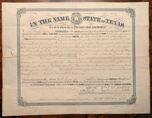
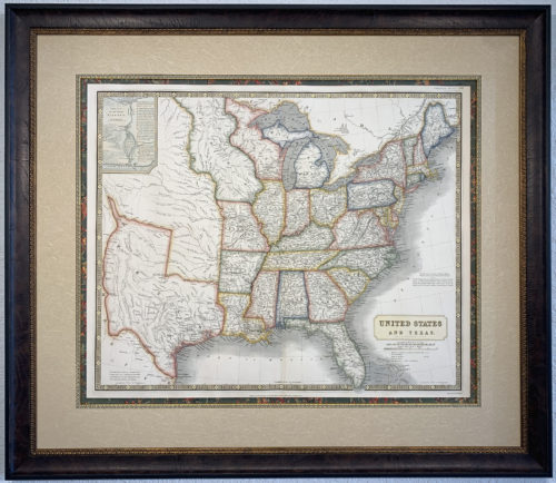
Sold
please contact the gallery for information on other Rare Original Texas Lands