The Houston Metropolitan Area 100 Years Ago
The Beginning of the Boom Times
$785 framed replica map approximately 44″ wide by 41″ tall
$485 unframed replica map approximately 32″ wide by 29″ tall
$485.00 – $785.00
The Beginning of the Boom Times
$785 framed replica map approximately 44″ wide by 41″ tall
$485 unframed replica map approximately 32″ wide by 29″ tall
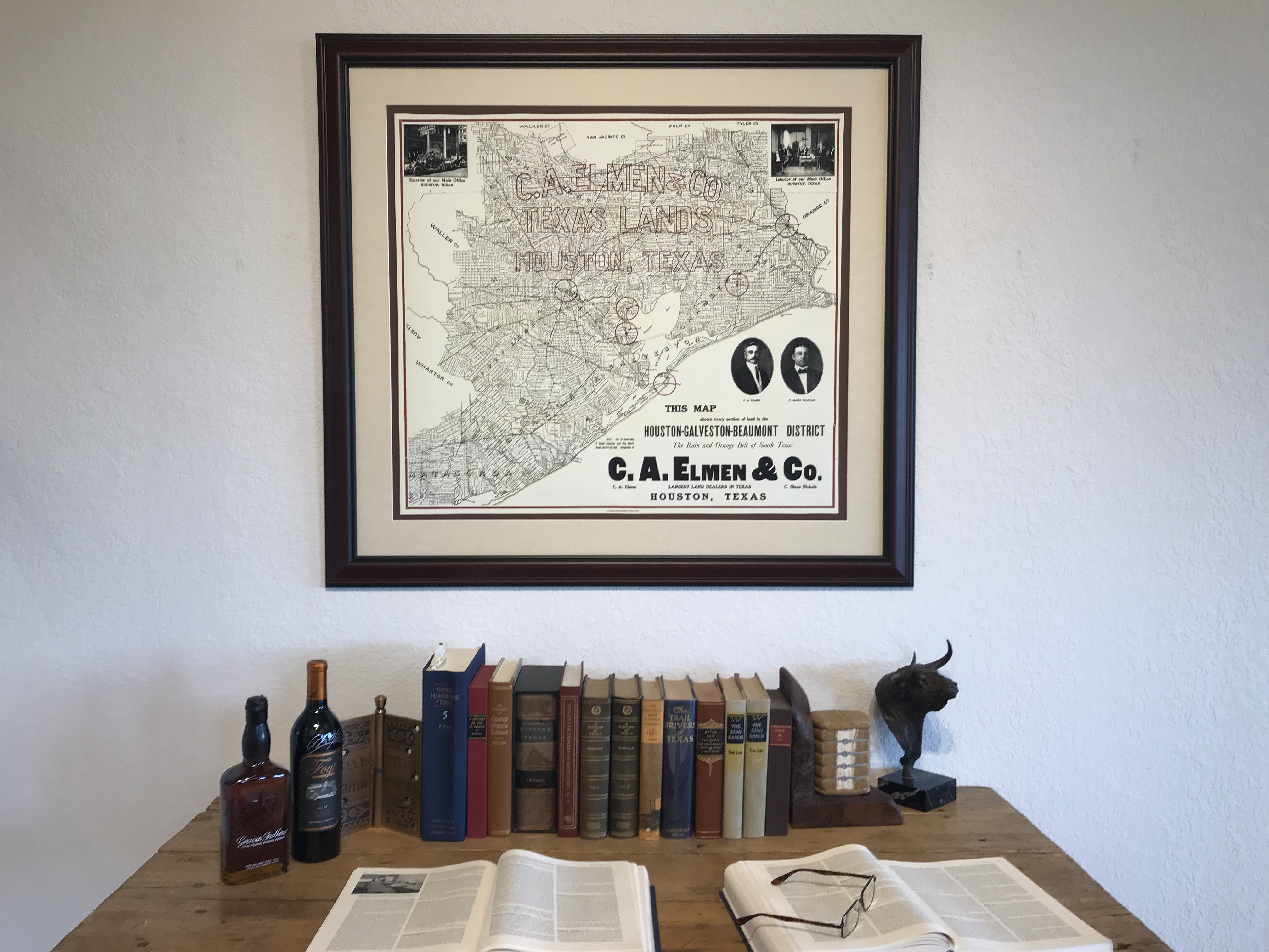
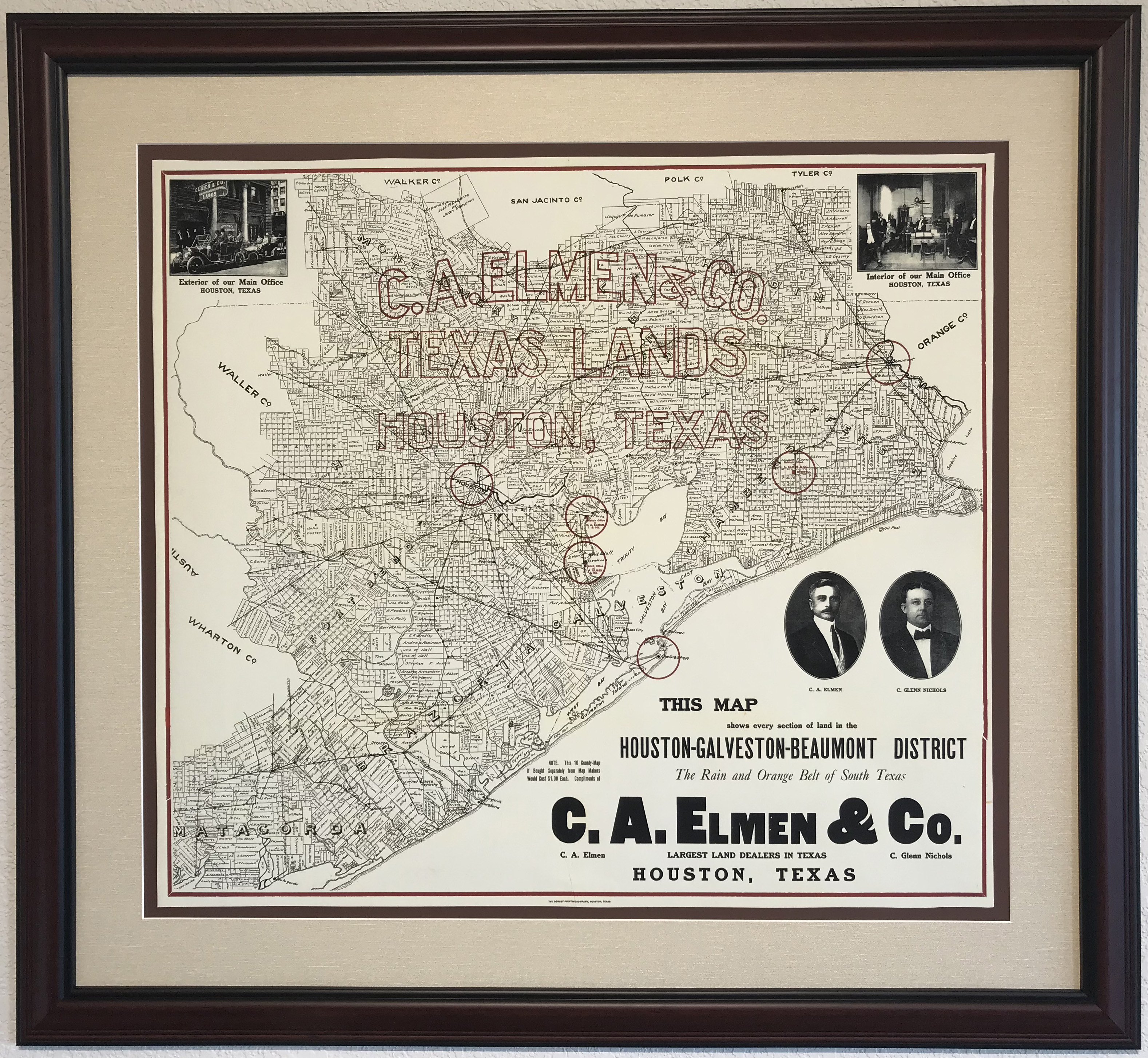
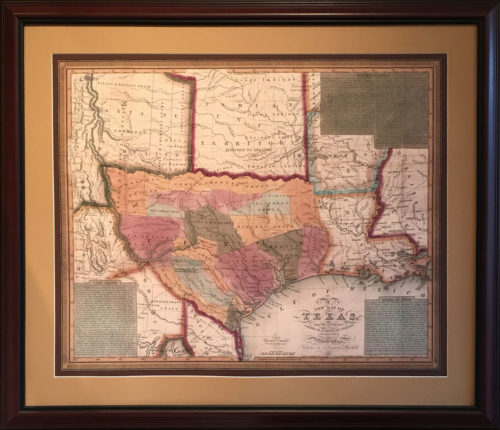
Real Estate marketing was a dynamic business in Southeast Texas in the early 1900’s. The Lucas Gusher had come in at the Spindletop Field starting the oil rush and agricultural markets were booming as well.
Houston was the new shining star of commerce after the loss of Galveston to a hurricane 15 years earlier. The new Houston Ship Channel is shown – it had been finished the year before this map was published after Mayor Rice had presented the “Houston Plan” in Washington and Jesse Jones had arranged for the sale of $1,250,000 worth of bonds to pay the city’s share of the dredging costs.
This map shows virtually all the individual owners of each tract of land in ten counties, from Beaumont on the east to the Brazos River west of Katy and north past Conroe. To the southwest, Sugar Land, Richmond, Rosenberg and all of Ft. Bend, Wharton and Matagorda counties are shown. The owners names include a who’s who of early Houston and Texas history including Stephen F. Austin.
Photographic vignettes in the top corners show a lively street scene in front of the downtown Houston office of the “Largest Land Dealers in Texas” and their well dressed office staff ready for business inside.
| Framed or Unframed | Framed, Unframed |
|---|
Our framed selections are individually hand-crafted to order. As such please allow approximately two weeks for most items to ship. Please call (512) 472-7701 or email li**@ga******************.com to discuss in-stock items or expedited availability.
We can ship selections all over the world, usually by FedEx. Everything is expertly packed and fully insured. FedEx charges vary depending upon distance, package size and shipping speed; please call or email us for specifics.
Generally, the shipping cost of a full scale flag runs between $45–$75. Most other framed items, including collector size flags and map replicas can be shipped for about $35.
As often as possible within Texas we try to deliver your order on our truck. This is especially true if you are getting several items at once.
We usually visit Houston, Dallas and San Antonio every couple of weeks, and special deliveries can be arranged as needed. It is our pleasure to try and personally deliver within Texas when possible.
FREE SHIPPING ● Give us a call (512) 472-7701 ● Send us a note inquire@galleryoftherepublic.com
Join our quarterly newsletter and receive special offers! We’d like to introduce you to the rich heritage of Texas! Dismiss